


Now available for iPad and iPhone.
Our famous Pilots “Free Flight” Atlas. Founded in 1998, is now available as an App for iPhone and iPad.
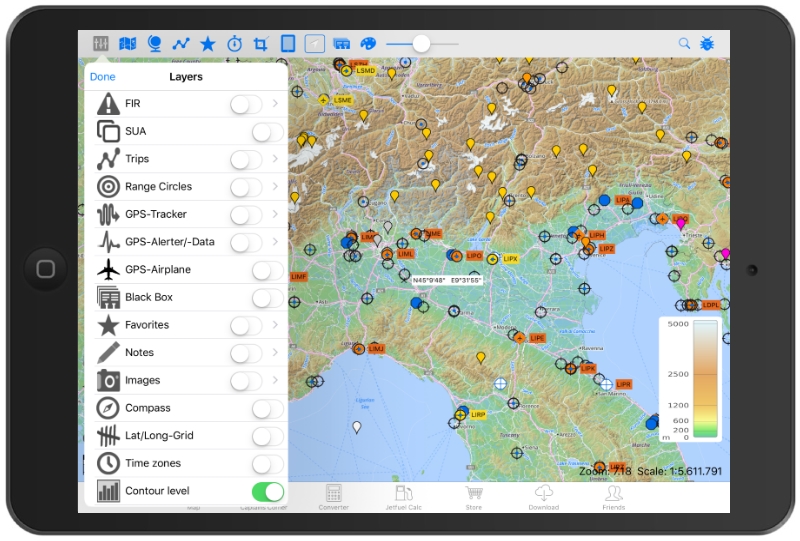
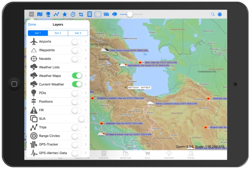
Detailed mapping with selectable aeronautical overlays.
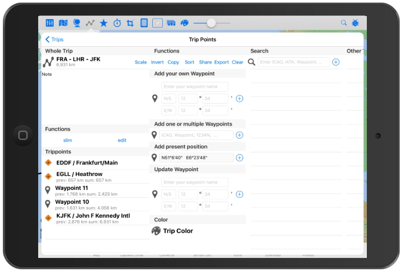
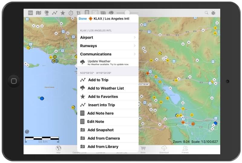
Create your charts with the information you choose. Add private airports, waypoints, favorite locations, tips, notes, photos and share with friends and colleagues or post for inclusion in the app for others to see.Create, edit and store your flight planed route by clicking on airports, waypoints, VOR´s, NDB´s or Lat/ Long or by using ICAO/ IATA-codes.
Insert and save your destination favorites, create trips, waypoints, photos or notes directly on the map. Implement screen shots from your online-map into the offline-map.
- Contour level by color (meter + feet).
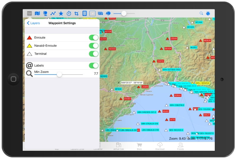
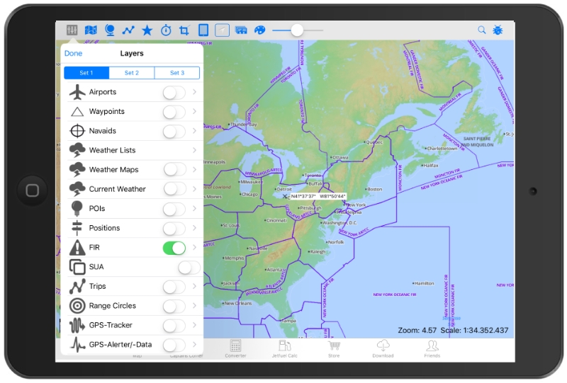
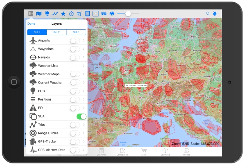
- 120,000 Waypoints (three different typs)
- 22,000 Airports (three different typs)
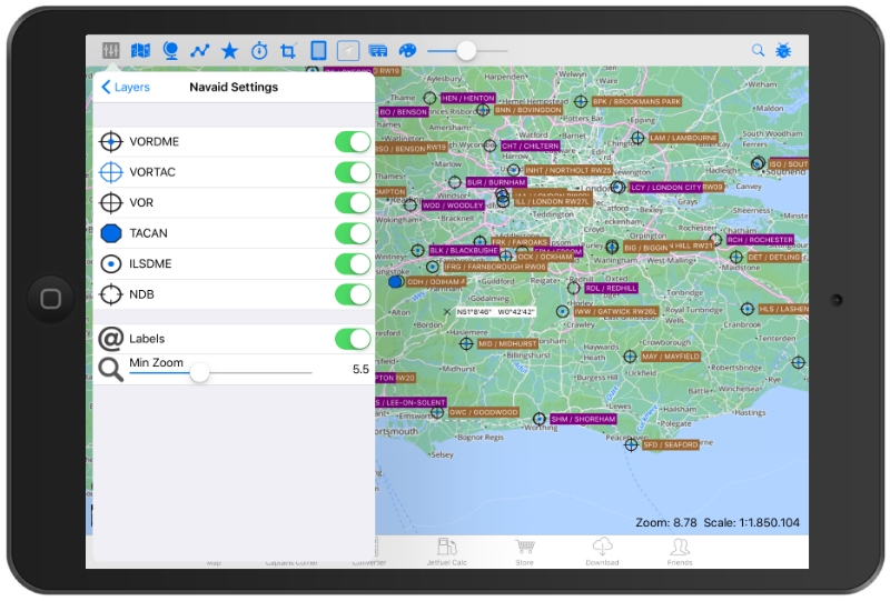
- 35,000 Nav-aid´s (VOR-DME, NDB, TACAN, VORTAC, ILS-DME)
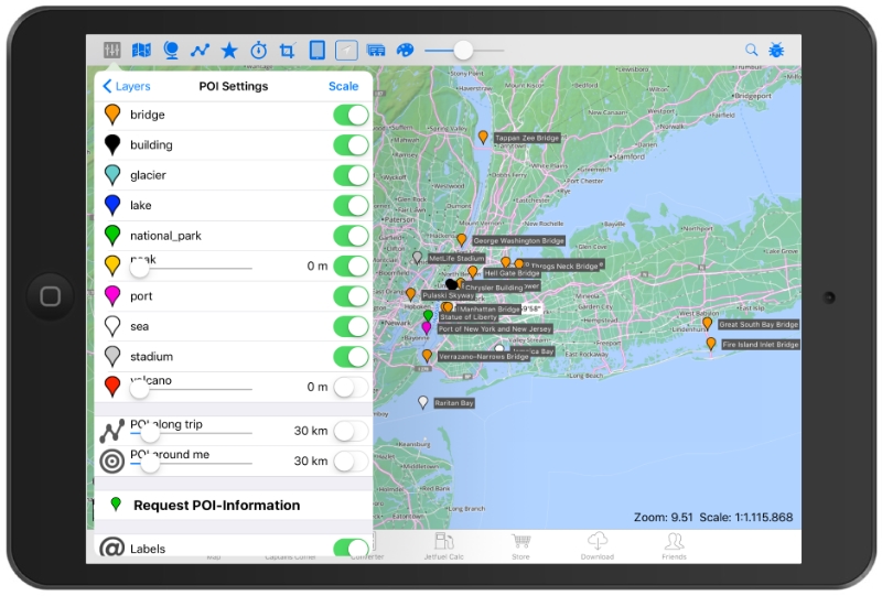
- 10,000 POI´s ( points of interest)
- FIR Boundaries
- Special Use Airspace areas (SUAs)
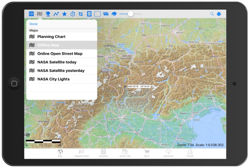
- topographical maps
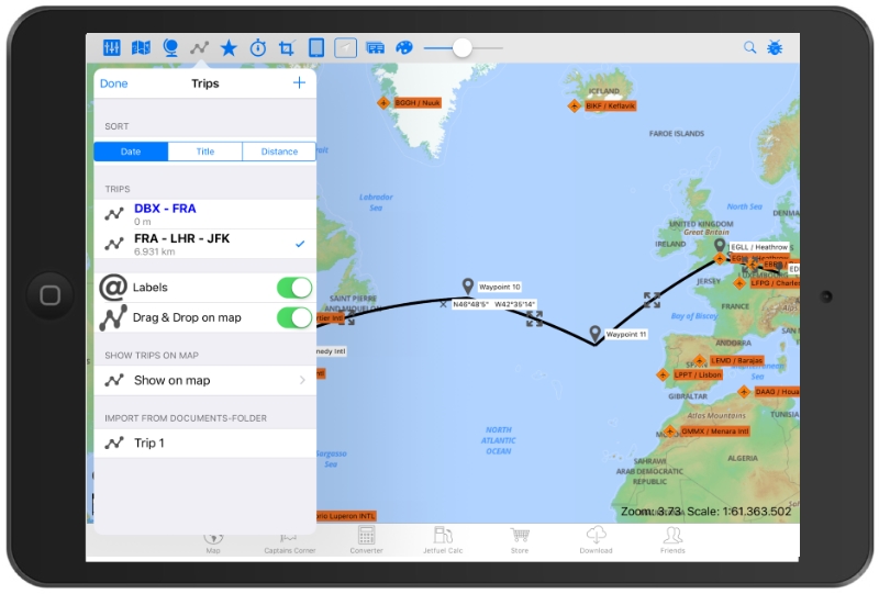
- Trip planning (by Waypoints, VOR´s, airports, NDB´s, ICAO/ IATA codes or Lat/ Long).
- Share, copy, invert or export your trip, delete/ edit single trip-points or whole trips. The whole trip-length is shown and also the distance between single trip-points.
- Show all your trips (or select your specials) in the map by different colors.
- 6 different charts on board: planning chart, offline map and online maps (OSM), NASA Satellite today, NASA Satellite yesterday and NASA City Lights.
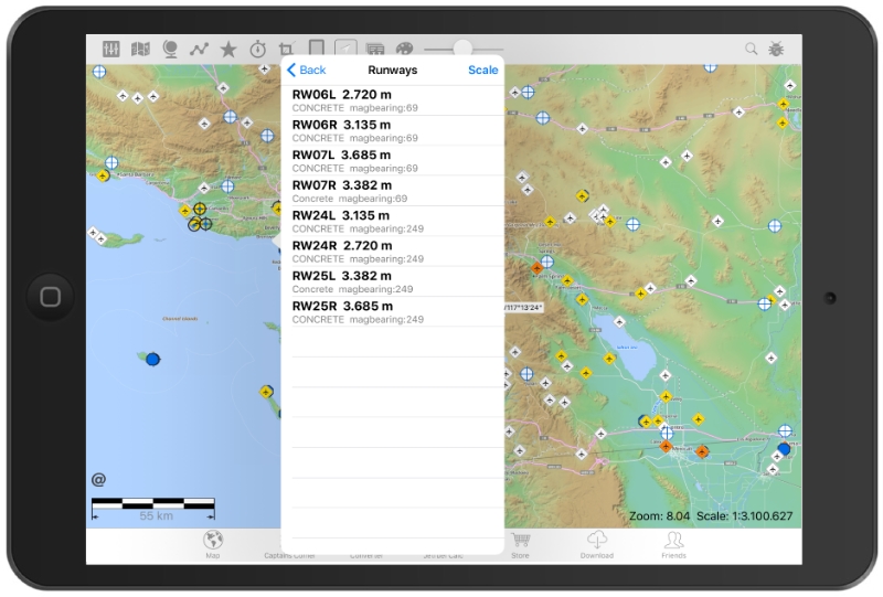
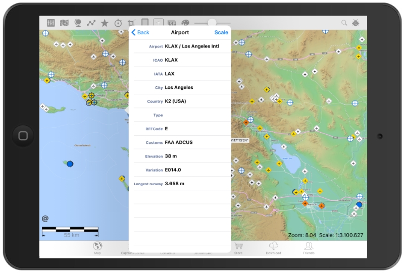
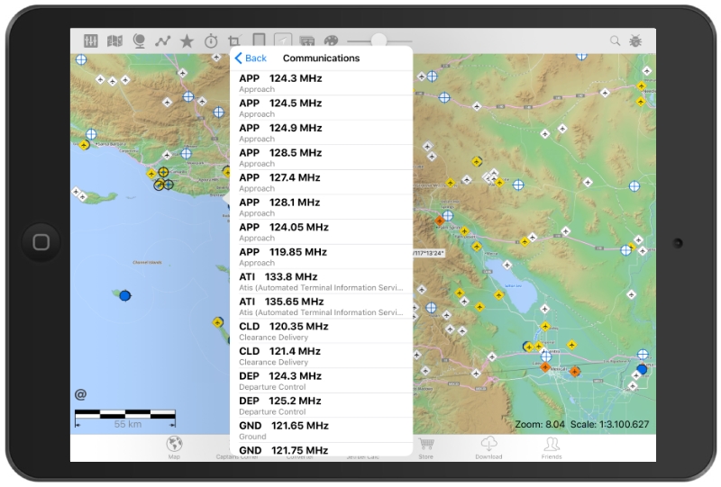
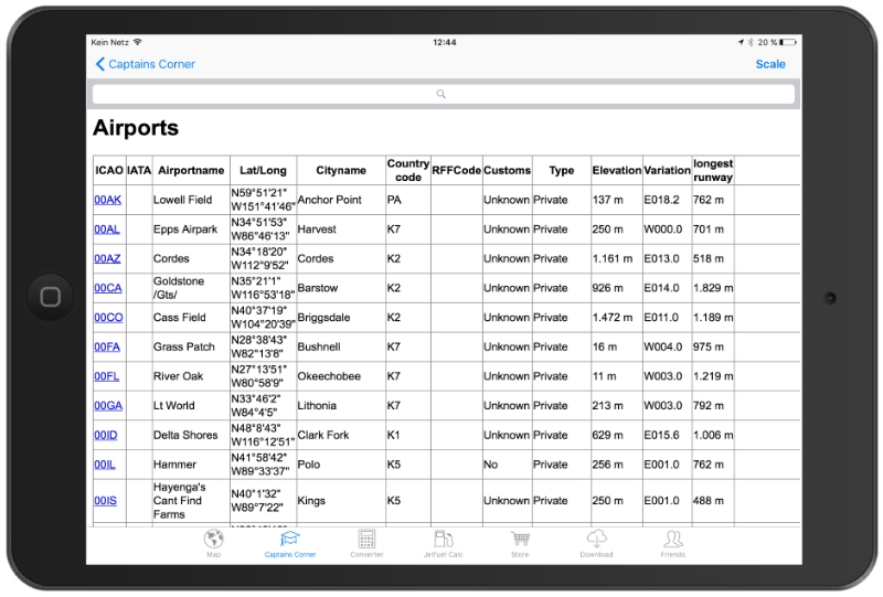
- Airports, Runway length, elevation, ICAO/ IATA, airport-name, city-name, Lat/ Long, frequencies, magnetic variation and much more
- Create range-circles around airports
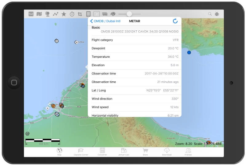
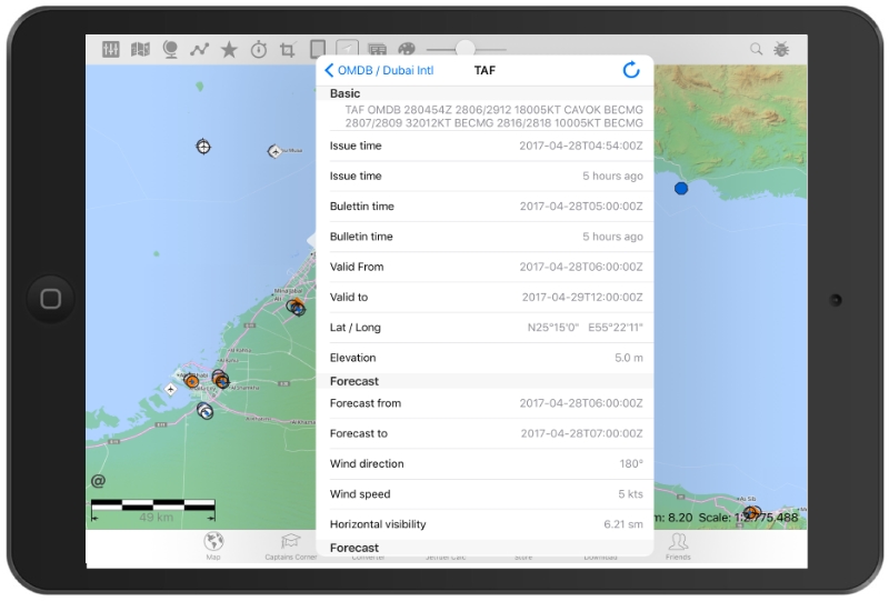
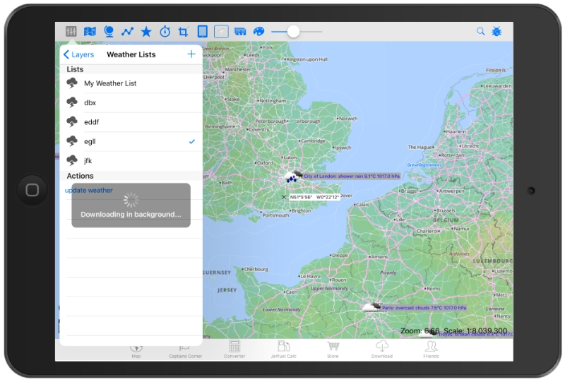
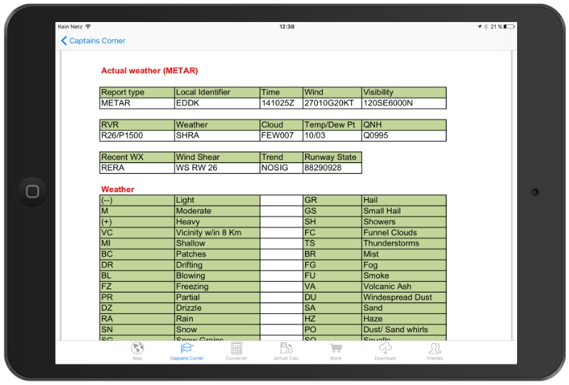
- METAR + TAF are available by clicking on the airport-icon and you can create/edit your own weather-list (along your trip/route).
- connect an external GPS
- delete and re-download the areas you need whenever you like.
Captains Corner reference stuff:
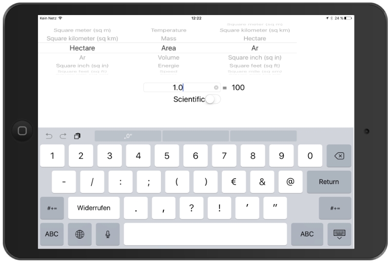
- Aviation Converter / Calculator (temp., mass, area, volume, energy, speed power, pressure, length, force..)
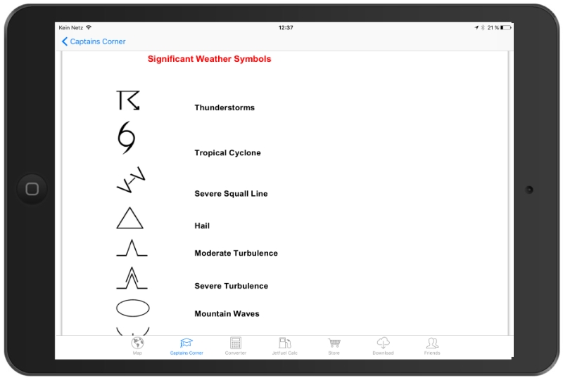
- Weather symbols
- Turbulence, VOLMET table
- SNOWTAM decoder (Notam + Metar)
- MEATAR decoder
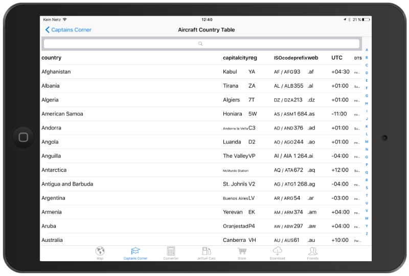
- General country Information (Capital city, reg.-code, ISO-code, dialing-prefix, time zone)
- ICAO prefix table
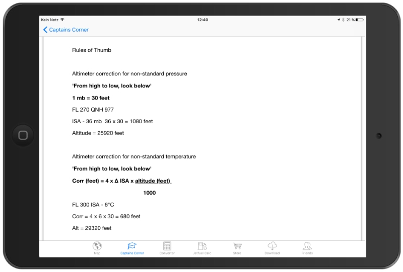
- Thumb rules
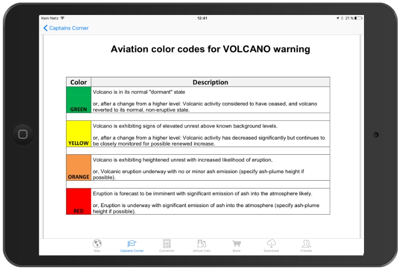
- Volcano warning
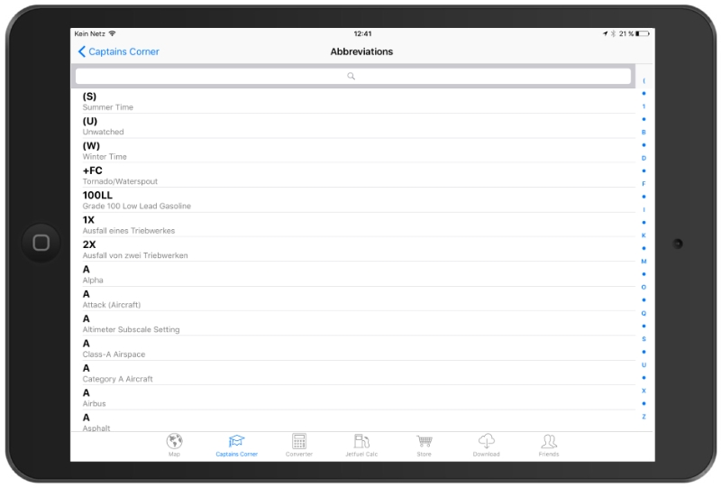
- Aeronautical abbreviations
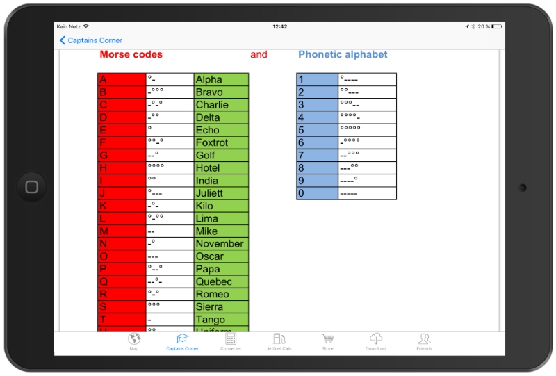
- Morse codes
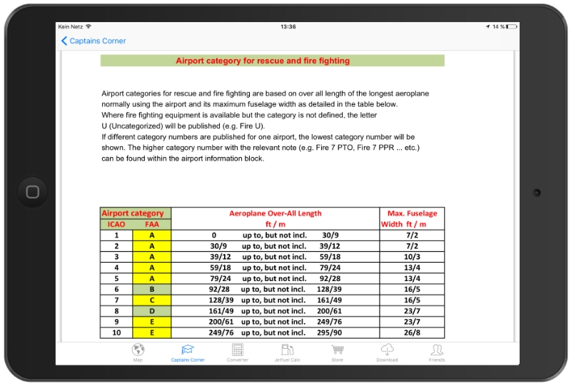
- Airport category
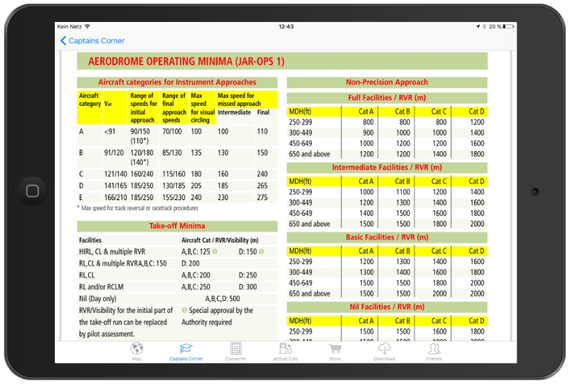
- Operating minima
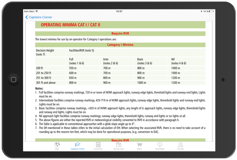
- Operating minima CAT I + II
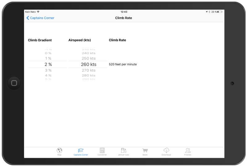
- Climb rate and Kerosine calculator
- Airport, Nav-aid, Waypoint, POI directory
- TAF decoder
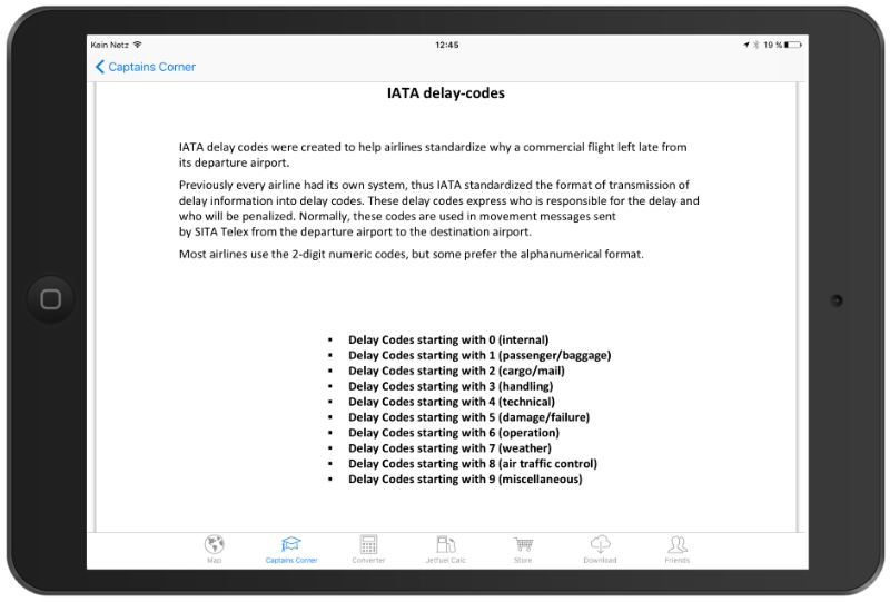
- IATA delay codes
- Dangerous goods
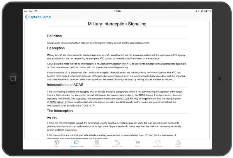
- Military Interception signaling
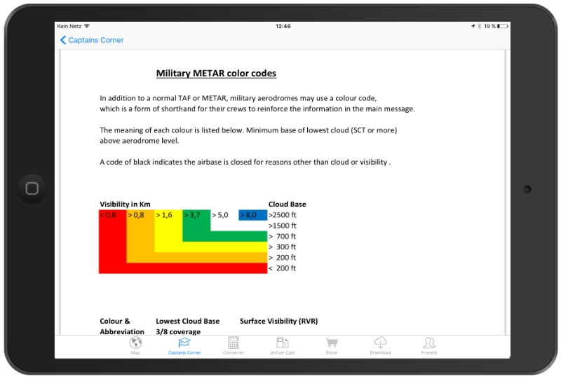
- Military MEATAR color codes
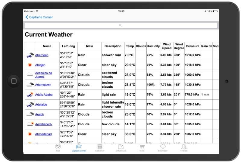
- Current weather
- De-Icing / Holdover times
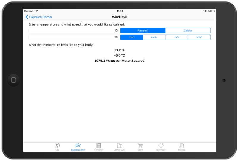
- Wind chill calculator
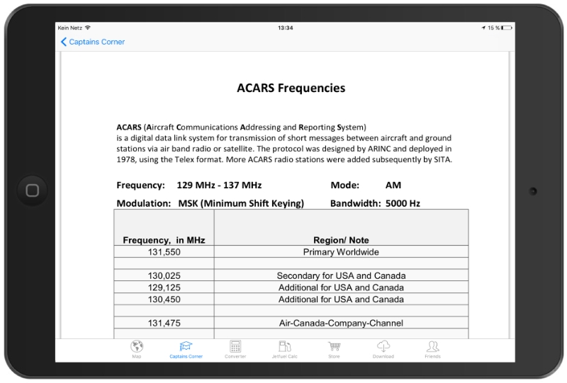
- ACARS Frequencies
- SOS-Emergency
- Time Zones
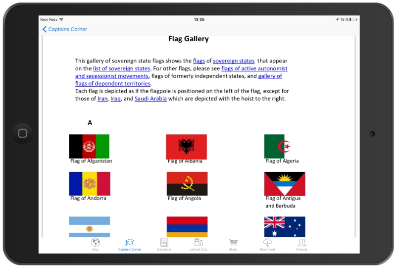
- Flags worldwide
Additional weather-overlay as an in-App-subscription: 1-month free trial. Length of subscription: one year. Payment: once a year, charged to iTunes-account. Automatically renews unless auto-renew is turned off at least 24-h before end of period (account settings).
The Weather-Layer is an yearly auto renewing in-App-Subscription for 3.99 USD with 30 days free trial.

